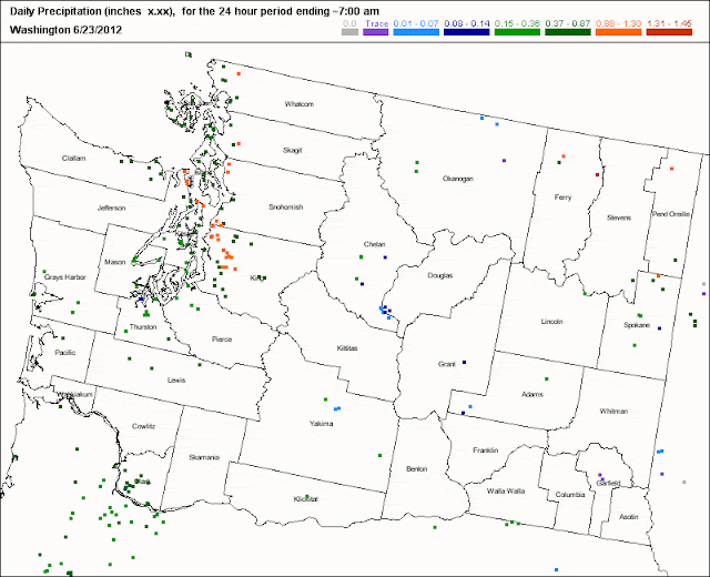
For those interested in the amounts of precipitation we have received, here is the 24 h amounts (ending 7 AM) from the cocorahs (volunteer) network. You can see the band of high precipitation values (orange color) that stretched from Issaquah, through north Seattle, towards NW WA.
Or if you prefer, the precipitation shown on the NWS site.
Correction: there were some minor records broken yesterday. NWS message this AM:
A RECORD RAINFALL OF 0.62 INCHES WAS SET AT SEATTLE-TACOMA WA
AIRPORT YESTERDAY. THIS BREAKS THE OLD RECORD OF 0.46 SET IN 1993.

...RECORD DAILY MAXIMUM RAINFALL SET AT SEATTLE WA WFO...

A RECORD RAINFALL OF 0.91 INCHES WAS SET AT SEATTLE WA WFO
YESTERDAY. THIS BREAKS THE OLD RECORD OF 0.46 SET IN 2005.
For some reason this did not get to the national records site at NCDC.


No comments:
Post a Comment