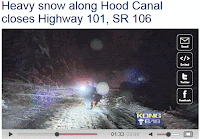
One major highway after another has been closed for extended periods recently as hundreds of snow-encased trees have fallen over the roadways, including SR-2 across the central Cascades, the Mount Baker Highway, RT 6 and 101, on the Olympics Peninsula. Large deposits of snow weighted the trees down until they toppled over.
 |
| Mount Baker Highway: WSDOT Photo |
 |
| Mount Baker Highway: WSDOT Photo |
 |
| SR-101 Closed |
 |
| SR-2 Trees Leaning Over: WSDOT Photo |
So were the trees falling? We have had periods of more snow, of more wind, of more rain. Periods that were colder. What is different this time?
Let's play detective!
 |
| When you have eliminated the impossible, whatever remains, however improbable, must be the truth....S. Holmes |
The last month has been a wet one over the region and the mountains have gotten large amounts of snow. But other years have had as much or more snow in the mountains (e.g., 98-99) without so many trees coming down. So snowfall alone is not the answer.
What about the locations and altitudes? The SR-2 tree falls occurred about 10 miles west of Leavenworth at an altitude of roughly 2400 ft (see mapP
The Mount Baker Highway tree falls occurred east of Maple Falls (see map, east of red A). Elevation about 1400 ft.
U.S. 101 on the Olympic Peninsula was closed between Shelton and Brinnon with trees downed not far from sea level. So the elevations varied.
I think there is an answer. There is something that all these elevations had in common during the period, something that I believe caused massive tree falls. So let me give you my hypothesis. Let's consider the facts, my dear Watson.
Fact 1: We know that the trees fell when they were weighted down with snow.
Fact 2: Snow is most "sticky" near and just below freezing (say mid-20s to freezing)
Fact 3: During really cold periods (our Arctic outbreaks) snow tends to be lighter, less sticky, and more easily blown off trees.
Fact 4: Major warm up periods (e.g., pineapple express atmospheric river periods) have very high freezing levels and rain at most elevations, resulting in melting and washing off snow from trees.
There WERE some unusual aspects of the past few weeks that allowed large amounts of snow to stick on trees until they fell over.
Thinks about it. This month we did not have any major Arctic, cold-air, outbreaks. So no really cold, light snow that doesn't stick well. We have NOT had any pineapple expresses or warm up periods that would melt the snow at a wide range of elevations. In fact, recent temperatures in the mountains have been AMAZINGLY steady. Let me demonstrate this.
Take a look at the temperatures (red daily high, blue daily low) at the Winton weather station run by the WA DOT. Winton (MTWINT, roughly at 2000 ft MSL) is several miles north of Leavenworth on RT 2...not far from the tree falls. Or Nason Creek (a bit farther north at 2000 MSL as well).
Only minor temperature variations. Temps never got above 40F and only below 20F on the 18th and 19th. Most of the two weeks (Dec 7-21st) before the major tree falls on RT 2 had highs in the low 30s and lows in the mid 20s. Perfect temperatures to deposit snow on trees. And winds were generally light...and thus not blowing snow off the branches. This is a very unusual situation.
What about the Mt. Baker Highway tree falls? Lets consider the Maple Falls station (a bit lower--670ft--than the section with the tree falls). AGAIN, amazingly constant temperatures in mid-December, with highs in the mid to upper 30s and lows around 30F. Go a little higher, to where the trees were falling, and temperatures were surely cooler..right in the range of maximum stickiness and deposition.
But you ask, what about the trees (less numbers) falling near the Hood Canal? Surely, it was much warmer there? The answer is no....that area can be unusually cool for the lowlands, as southeasterly flow banks cool air over that area. Consider Lake Cushman, which is close to sea level, and on the SE side of the Olympics, not far from 101. A number of day had highs in the lower to mid thirties, starting December 19th. And yes, temperatures were relatively constant.
So my hypothesis is that we had a wet, snowy period with consistently cool, but not super cold, temperatures in a range that promoted sticky snow. No major wind events to blow off snow. No pineapple express warming. It all game together in a very unusual way, causing massive snow loading on trees. Another contributor might be the mild temperatures that have left the ground unfrozen and thus less able to hold the trees in place. Perhaps one of you have an alternative theory...if so, I would like to hear it!
Certainly, not "elementary."


No comments:
Post a Comment