Downtown Ellensburg: Picture Courtesy of Stephers
Another picture by Stephers...but NOT a tornado. Rather a heavy rain shaft descending from a large convective system
Another picture by Stephers...but NOT a tornado. Rather a heavy rain shaft descending from a large convective system
And for me there was a special touch: I flew over some of the storms on my way back from a meeting!
As I noted in my last blog, the air over the region has the potential for major thunderstorms activity if there is sufficient lift to initiate the action.
It started quite early, with a collection of severe thunderstorms passing over the Tri-Cities and moving northeastward. Here is a radar image at 9:08 AM: red is very heavy rain or hail.
About an hour later I flew just south of these storms on my way returning from Denver. My flight was at an unusually high altitude (40,000 ft) and it was clear that some of the thunderstorm tops getting very close to our flight level. Here is a picture from my vantage point:
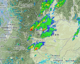
But then the amazing happened, a continuous train of very strong thunderstorms started to develop along the eastern slopes of the Cascades and never stopped all day. Let me show you some samples at a few times. First, at 12:30 PM
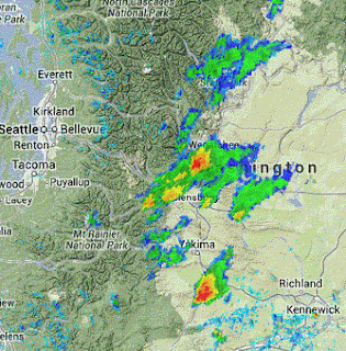
A fascinating subtlety was that the radar showed a nice case of storm splitting northeast of Yakima. Here is the radar 45 minutes later...you see the two red areas of heavy precipitation?
2:29 PM
4 PM--still going
And here is one at 6:40 PM...it hasn't quit!
You see that bright red echo (very intense) just east of the Cascade crest northwest of Wenatchee? According to the radar it reached 31,000 ft and it was clearly visible here in Seattle. To prove this, I took a quick pic of it from Mathews Beach Park in north Seattle.
According the observed 12-h rainfall totals some observing locations received .5 to 1 inches of rain from these storms (see graphic)....but I am sure that much heavier amounts fell at places without rain gauges.
Thunderstorm activity was substantial on the east side Saturdaydue to the large amount of potential instability (high CAPE)--see graphic below-- and the lift of some weak disturbances approaching from the southwest. Furthermore, the mountains produce their own upward motion that can help initiate convection.
According to our computer models, tomorrow should be far drier, with very little thunderstorm activity.


.jpg)


No comments:
Post a Comment